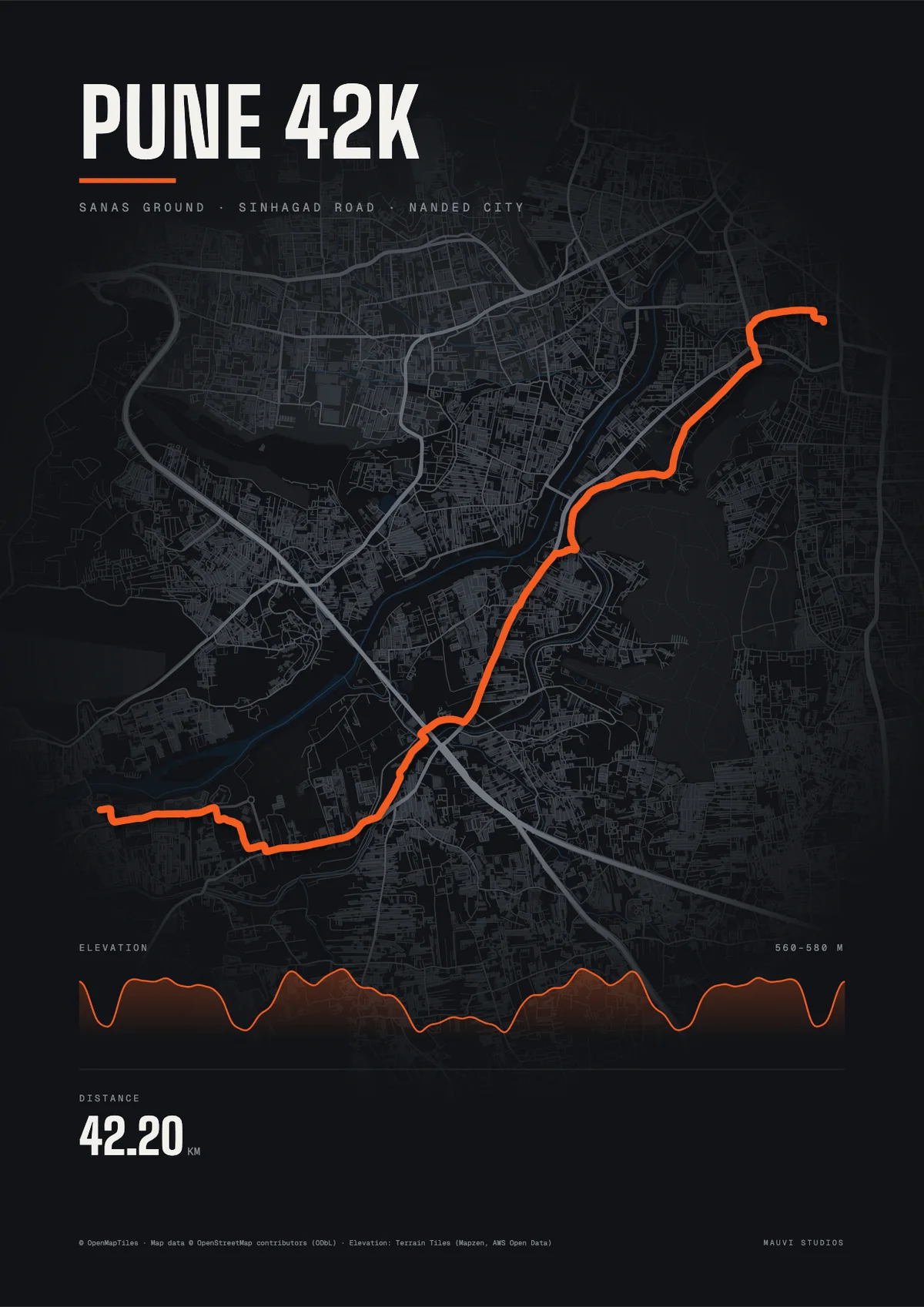
Pune Marathon route map
The 40th Pune International Marathon is on Sunday, 6 December 2026. Here is where it starts, what the 42.195 km course passes, and how to keep your run.
- Date
- Sunday 6 December 2026, as listed by race calendars; confirm on the organiser’s site.
- Distance
- 42.195 km (full marathon)
- Start
- Baburao Sanas Ground, near Saras Baug
- Finish
- Back at Sanas Ground on the course published for the 38th edition.
The course
The course published for the 38th edition passed Saras Baug, Dandekar Bridge Chowk, Sinhagad Road and Nanded City (a 10.5 km loop).
Our drawing runs from Sanas Ground past Dandekar Bridge and down Sinhagad Road to Nanded City, and back. It follows the course published for the 38th edition and leaves out the loop inside Nanded City, so it is shorter than the real course and is not the official map.
Ran it? Keep it.
Export your Pune Marathon run from Strava or Garmin as a GPX file. Make a free poster of it, or have the route 3D-printed with its real hills and framed.
Questions
When is the Pune Marathon 2026?
The 40th Pune International Marathon is listed for Sunday 6 December 2026. Confirm the date on the organiser’s site.
Where does the Pune Marathon start?
At Baburao Sanas Ground near Saras Baug, with a pre-dawn start.
What is the Pune Marathon route?
The course published for the 38th edition ran from Sanas Ground past Saras Baug and Dandekar Bridge Chowk, down Sinhagad Road to Nanded City, with a 10.5 km loop there, and back to Sanas Ground.
Is the Pune Marathon India’s oldest marathon?
It is often described as one of India’s oldest, first held in 1983.
Can I get my Pune Marathon run as a poster or a frame?
Yes. Export your run as a GPX file from Strava or Garmin, upload it to our free poster maker, or make it a framed 3D print with the real elevation.
Sources
- Free Press Journal: 38th Pune International Marathon (course)
- Fat Marathoner: Pune International Marathon 2026 (date, start)
- Wikipedia: Pune International Marathon
An independent guide by Mauvi Studios. Map data © OpenMapTiles, © OpenStreetMap contributors (ODbL); elevation: Terrain Tiles (Mapzen, AWS Open Data).