Mumbai Marathon route map
The Mumbai Marathon is on Sunday, 17 January 2027. Here is where it starts, what the 42.195 km course passes, and how to keep your run.
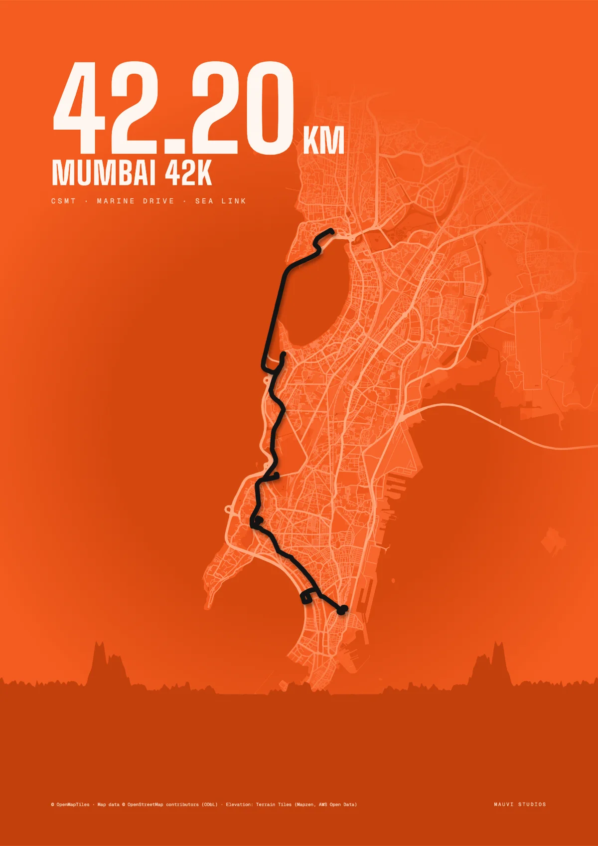
- Date
- Sunday 17 January 2027, as listed on the organiser’s race page.
- Distance
- 42.195 km (full marathon)
- Start
- Chhatrapati Shivaji Maharaj Terminus (CSMT)
- Finish
- CSMT, according to the organiser’s race page (one runners’ guide names Mumbai Gymkhana instead, so check the final course map).
The course
Runners’ guides describe the full marathon passing Marine Drive, Pedder Road, Worli, Mahim and the Bandra–Worli Sea Link.
Our drawing runs out from CSMT along Marine Drive, over Pedder Road and Worli, across the Sea Link to Bandra, and back the same way. It is an approximation from the landmarks above, not the official course map.
Ran it? Keep it.
Export your Mumbai Marathon run from Strava or Garmin as a GPX file. Make a free poster of it, or have the route 3D-printed with its real hills and framed.
Questions
When is the Mumbai Marathon 2027?
Sunday 17 January 2027, according to the organiser’s race page.
Where does the Mumbai Marathon start?
At Chhatrapati Shivaji Maharaj Terminus (CSMT) in south Mumbai.
How long is the Mumbai Marathon?
The full marathon is 42.195 km. Shorter categories, such as the half marathon, run on their own courses.
Does the Mumbai Marathon go over the Sea Link?
Runners’ guides name the Bandra–Worli Sea Link and Marine Drive as highlights of the full marathon course. Check the official course map for this year’s route.
Can I get my Mumbai Marathon run as a poster or a frame?
Yes. Export your run from Strava or Garmin as a GPX file and upload it to our free poster maker, or turn it into a framed 3D print with the real elevation.
Sources
- Organiser’s race page (date, start and finish)
- Fat Marathoner: Mumbai Marathon 2027 guide (course highlights)
An independent guide by Mauvi Studios. Map data © OpenMapTiles, © OpenStreetMap contributors (ODbL); elevation: Terrain Tiles (Mapzen, AWS Open Data).